

Designing Territories From Within
Conceptualizing the territory five years in

This article argues that in fragile territories the effective object of design is rarely the architectural project and more often the protocol; a shift that requires the designer to abandon the aerial perspective of the planner and work from inside the territory, as a constitutive part of the system being transformed.
The article was written by Gabriele Pizzi in response to an invitation to speak at Terremosse SESAM x Amatrice, an architecture festival organized in Amatrice in July 2026. Liminal member Sofia Manieri, whose thesis work was rooted in Amatrice, is one of the protagonists behind the festival.
This essay was born of a reflection on the past years of research at Liminal and how they have impacted the way we understand our role as designers working on the territory, or rather, in the territory. A transformation that was very much guided by the change in perspective that the work at Liminal produced through experimentation and extended fieldwork, ultimately producing a dislocation of our position as practitioners in relation to the object of our work.
This change of perspective happened slowly, and at the beginning, especially in the first Challenges,1 we came equipped with the disciplinary lens of architecture and planning. We started with naive ambition, armed with a team of mathematicians, landscape architects, and scientists from the best schools, thinking that any issue could be tackled through talent and courage. Instead, we found that our own guiding perspective was the limiting factor and embarked on a journey slowly unveiling both its limits and its value.
We came out, understanding that before we can build in fragile places, in the traditional sense the discipline trained us to imagine, many preconditions must be met. That is, if we don’t want our project to become a cathedral in the desert, but a vital constituent of the territorial system. The seeds of our later work were, however, already present in the very first steps.
From the beginning, when we started interfacing with this new mode of embedded design and direct engagement with the people inhabiting a place, we understood that we could not work on the project itself until we unlocked the territory’s capability to host one. And to achieve that, we would first have to understand the dynamics and conditions of the place, its actors, whether they could coordinate around a vision, whether there were the right incentives, the right infrastructure, the right governance, and the right ecology.
We discovered, after years of trial and error, that before the project is possible, we must dive deeper than a site visit. Diving deeper, we discovered that the object of design where our contribution is most effective is rarely the architectural project and more often a protocol.
The Territory From Above
We decided to work in rural areas and in fragile regions because we wanted to tackle head-on the crises of our civilization. Not by staying where they were slowly unraveling, in the metropolis, where the redundancy of the system could absorb them long enough that they never showed completely. Instead, we decided to go to the leading edge of the breakdown in those places where the cultural, demographic, economic, and ecological pressures are the strongest, because if we were ever to find solutions to those issues, it was most certainly there.
These are territories caught in what Gunderson and Holling call the release phase of the adaptive cycle, when the structure accumulated in centuries is coming undone faster than reorganization can absorb it.2 And working in places with no buffers, where few people manage everything, where the social, technical, and economic layers are ever thinner, reveals the limits of a specialist lens inherited from our disciplinary tradition but built for other times and places. In doing so, it dislocates our stance from the aerial perspective of the modernist architect to a newly embedded perspective from which the work is inside and co-evolves with its object.
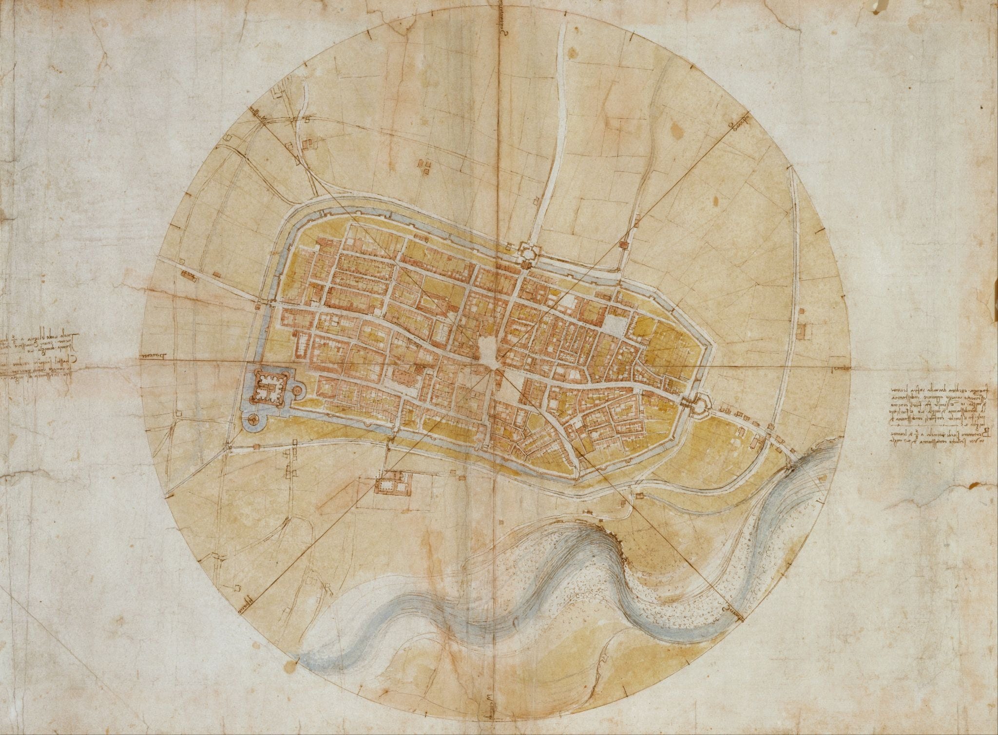
Ever since Leonardo drew the plan of Imola, our image of the city has increasingly been an orthogonal image from the sky. An image from the top, perceiving the territory as a surface on which different fluxes and land uses overlap. But as architects, we primarily see space as a space of solids, pieni e vuoti, in which we can find the space for our creation. This lens, however, tends to limit us to the spatial project as a means of intervention. Even when, in our case, it does not best serve the larger goal of moving the territory from a state of fragility to one of renewed capacity to reinvent itself.
This was clear from the first Challenges, in which, alongside architectural proposals, we started experimenting with new ways of knowing the territory. Quickly, we found that mapping, with the goal not of surveying a site but of revealing dynamics of the territory that the actors themselves were not fully aware of, was much more consequential. That is, because there was no way to get our project built, not until the territory would recognize and reorganize to integrate the new dynamics given by its condition. We found that we could inhabit the uncontested space of information and its flows. We could produce a new self-image of the territory, of its heritage, of its landscape, and of its history that could in turn reorient action.
That proved to be more effective: starting from information, going to coordination, then to incentives, and then to the necessary infrastructure, which could take an architectural form, but not stopping there and going to landscape and geology. And back to information. Even when it was too early for the plan, we could go in. By going in, we started understanding that the multi-layered system we were working in had indeed many more points of intervention than we previously imagined.
The Territory From Inside
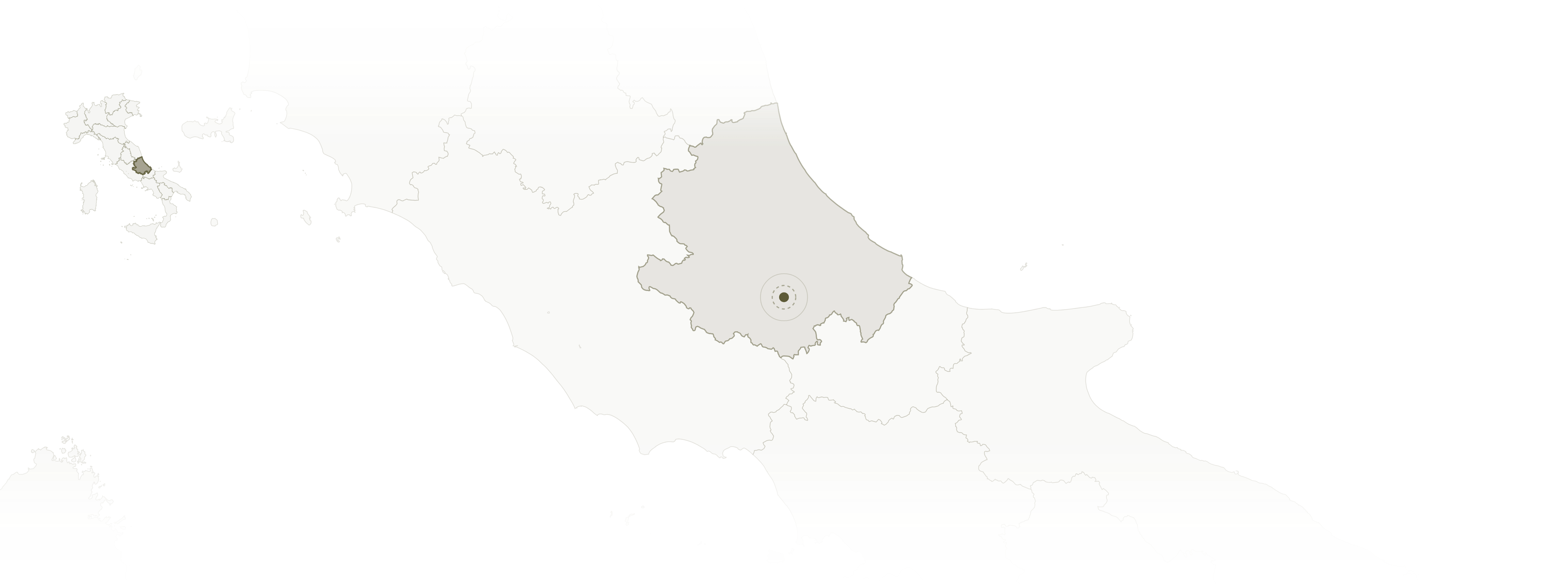
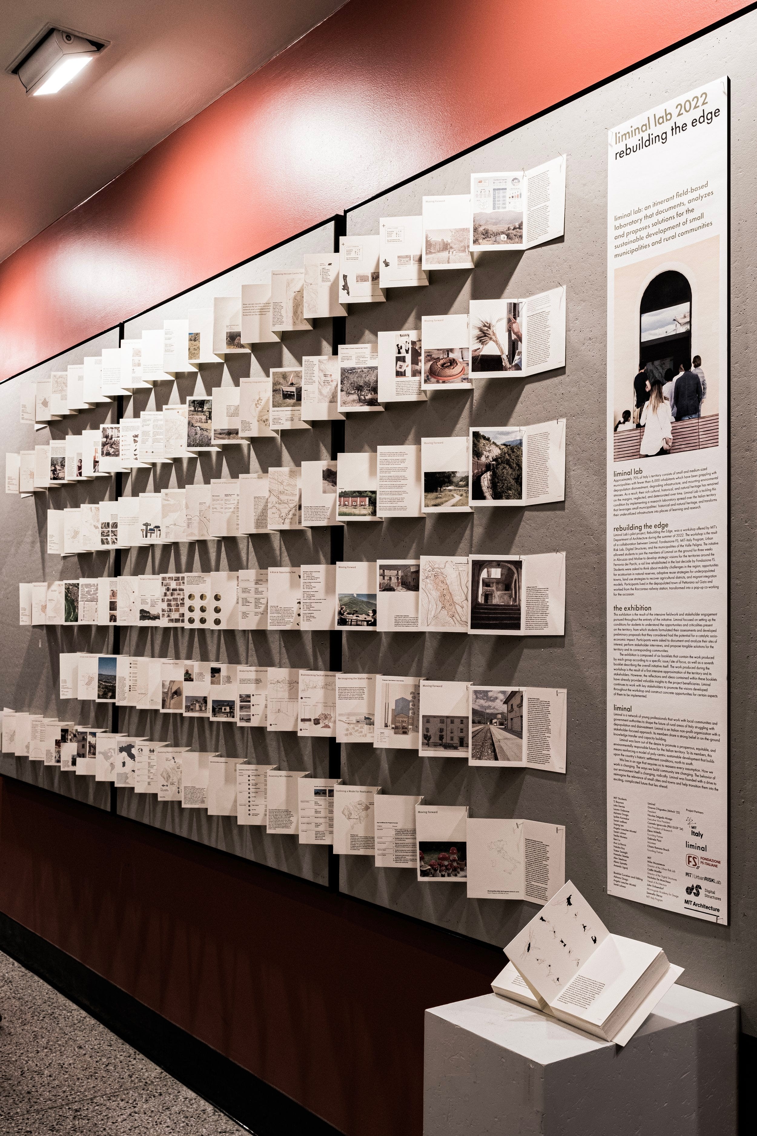
Already in the summer of 2022, in Pettorano sul Gizio and later that year in Monti Prenestini, information and coordination started emerging from the master planning. While it was the first encounter with the limitations of our instincts in these settings, Rebuilding The Edge was also the moment where all aspects started manifesting: from feasibility studies for spatial interventions to reinforce existing material flows to the informational layer.
We were both redesigning train terminals on tracks that were being renewed and documenting process flows of working migrant integration programs in small towns. We identified coordination as an additional precondition, as it became clear that the production of a new cohesive awareness of the territory for the actors themselves was necessary to make the projects, conceived as new material connections between actors and activities, possible. Both things informed the work of the summer of 2023, which was entirely devoted to going inside the territory to understand it firsthand.
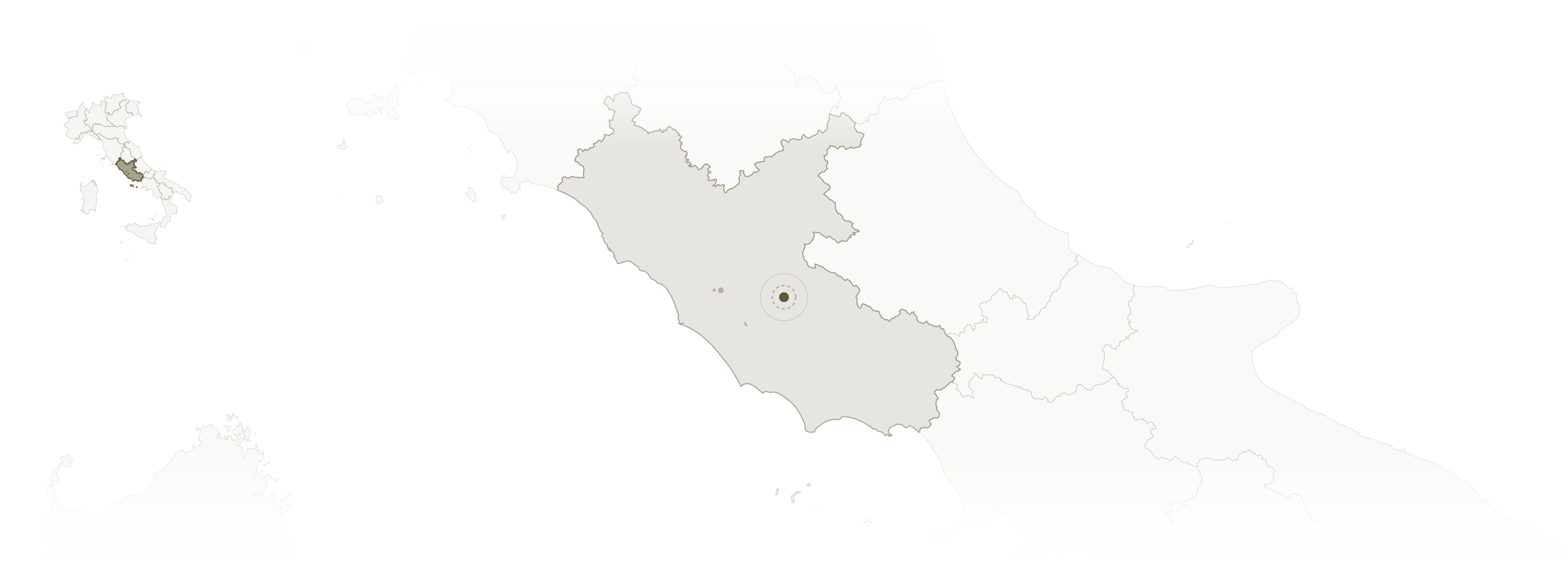
In 2023, we spent months consecutively in Monti Prenestini, with two goals: building an identity for the territory and the three towns through in-depth engagement with its actors and landscape, and producing an archive of 360 footage that could function as a checkpoint in time of the state of the town, a tool to understand its state. And to improve its digital navigability by increasing the coverage and visibility of points of interest online. The next year, we tried to make sure addresses were searchable to ensure packages and services could reach residents reliably and that the points of interest mapped the previous year would be reachable, to make the place livable and attractive for residents and visitors.
But beyond the digital infrastructuring and recording of the territory, from this experience, what emerged was that it was exactly here, in between the actors, the new technologies of knowledge, and the physical dimensions of the territory, that we could have the most impact. By building the protocols that could change the relationships and awareness between these different dimensions. Not only increasing access to modern services, but also reactivating new feedback loops, leveraging the informational as an access point to enter the territory, and to its social and spatial aspects through it.
We stopped being on top of a map we completely grasped, and found ourselves inside a system that had to be discovered relationally, from within. Discover Monti Prenestini was dedicated to this exploration through the documentation of the territory and the construction of a shared identity between the three towns of Castel San Pietro Romano, Rocca di Cave, and Capranica Prenestina. If, through the navigation information, we were building a technical self-understanding of the territory and a physical coordination infrastructure for the material flows, through the development of a territorial identity, the infrastructure was that of relation, reflection, and readiness to act together towards a shared vision.
On paper, the development of a platform; in reality, by documenting the territory visually and through conversations, getting to know it through its inhabitants and their vision of it, we synthesized the image of the territory in a single artifact, which, presented back to it, became the starting point of a long chain of new conversations. These conversations, in turn, highlighted many necessary next steps before the territory could benefit from its new identity and image and gave us a map of the next Challenges to tackle: addresses, trails, landscapes, and economies that could be sustainable.
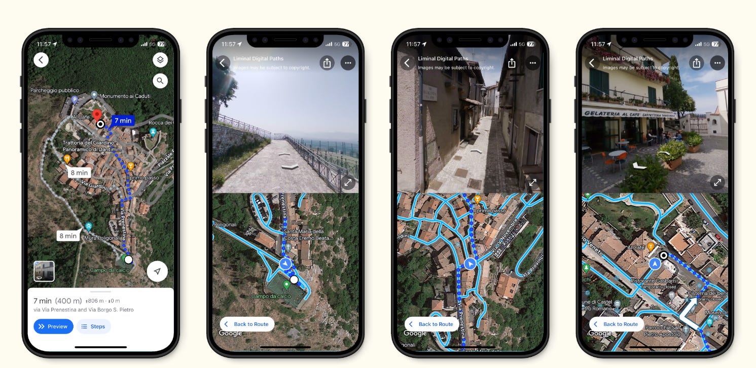
The next year was completely devoted to these issues, spending months on end in place, working on short, focused sprints on specific problems. Not the territory as a whole anymore, but single leverage points that had been unveiled through the previous Challenges.3 At those leverage points, build experiments, visions, and protocols that, when exposed to the community and the reality of the field, revealed their faults, but most importantly where in the system more work was needed to make them useful, or real. Each artifact became both a stepping stone and the diagnostic infrastructure that could show us what to do next.
Transitioning a Landscape was part of this cycle, and maybe the first time in which we understood that, indeed, by being inside, our role was that of closing the loop between the different layers. The output of the challenge was a protocol for the activation of a new economy on the edges between the advancing forest and the surviving pastures, turning the ongoing ecological succession into an opportunity. But more than service design, this challenge was a moment of synthesis between the deepening cascade of questions we had asked so far. And in a sense, it revealed the recursive nature of our new understanding of the territory.
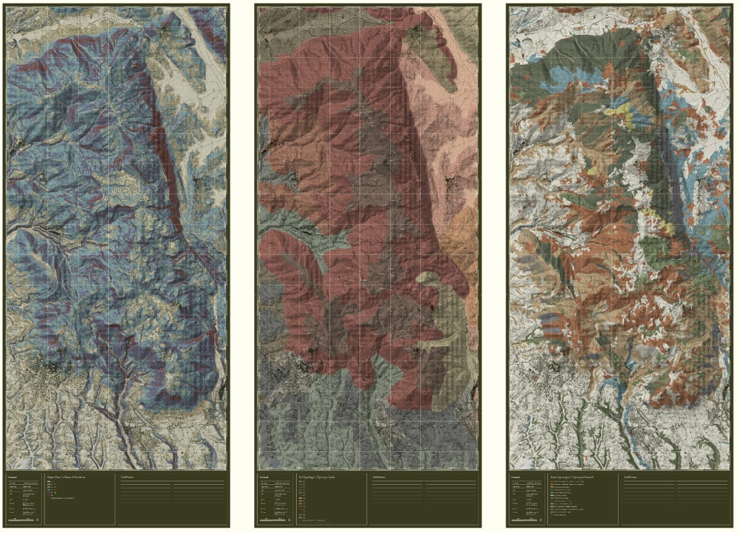
Starting from the sensing and representation of the dynamics of ecological successions, we then spent the time on the ground engaging with the actors involved in the productive management of the territory to understand their perception of the history and change of the territory. From there, and the possible futures that emerged, we spent the remaining time imagining not a masterplan for this landscape, but a protocol that could weave together this new understanding, vision, coordination, and incentives. The protocol itself at the end became a boundary object that, when presented to the territory, revealed its shortcomings and unveiled the next necessary steps of inquiry.
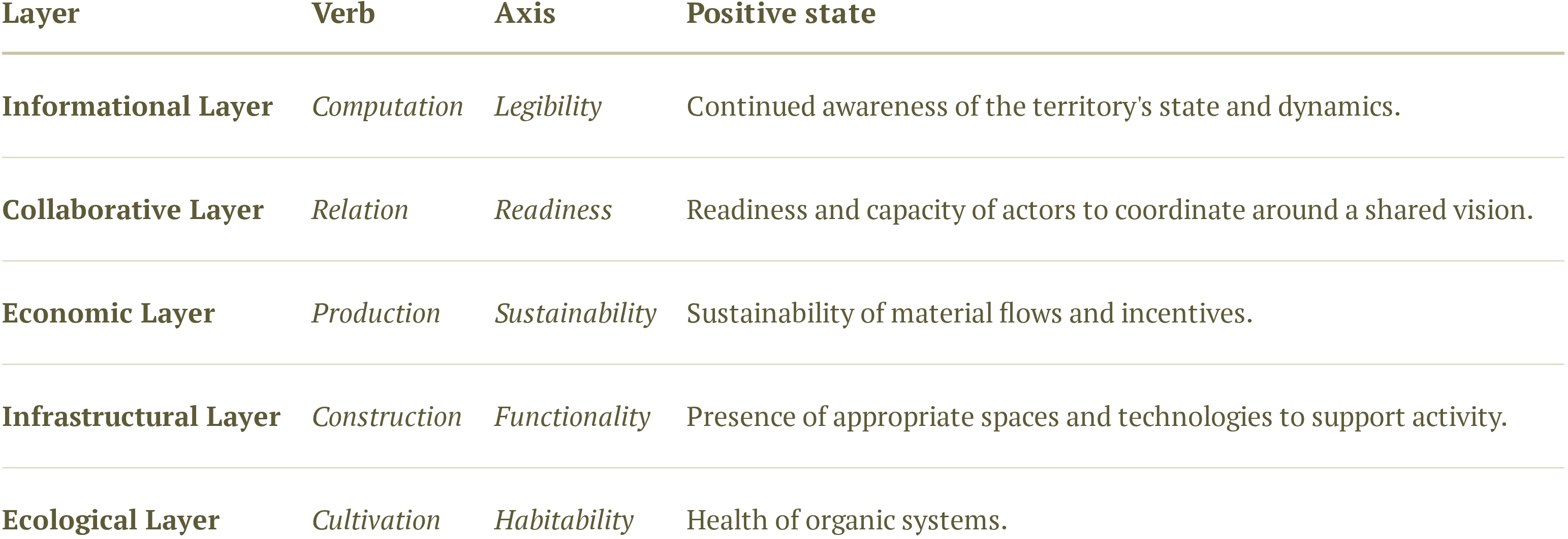
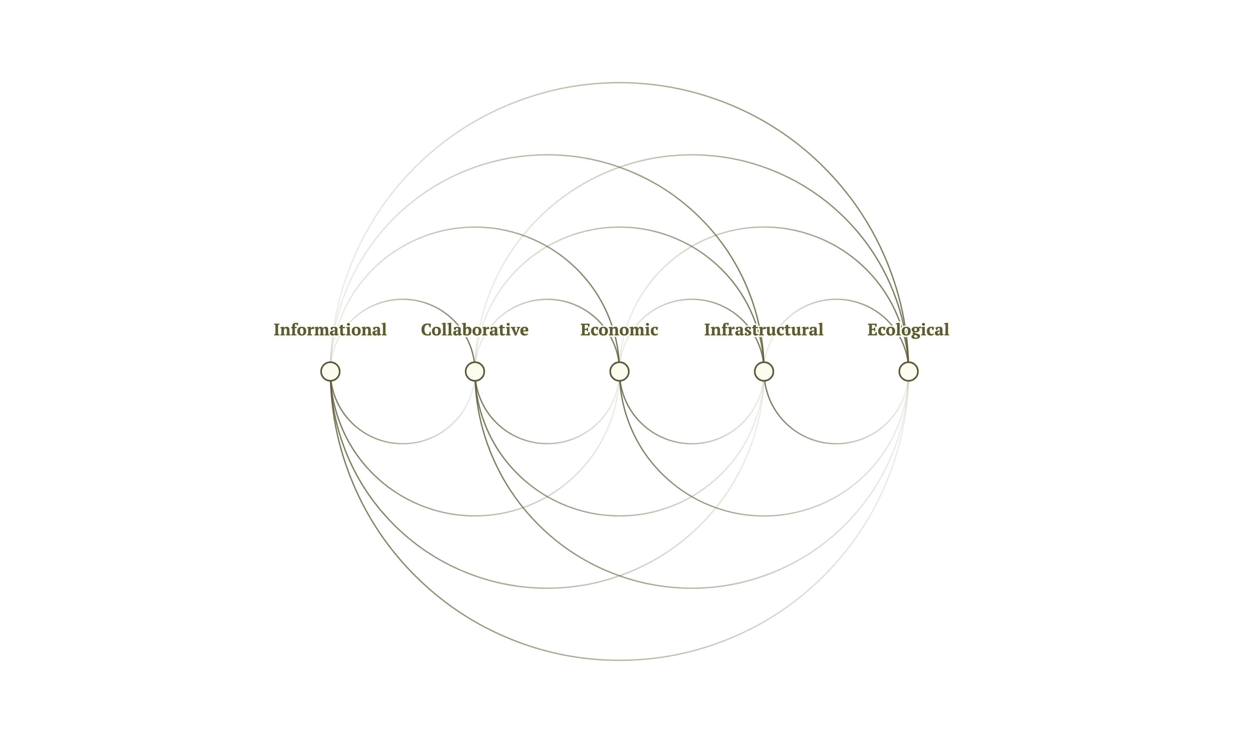
Transitioning a landscape and the Challenges that followed that summer deep into the fall started revealing the deepening gradient and the stacked nature of the territorial system. In a way, it revealed a sequence of questions to arrive at architecture, where we started from, and from architecture to the ecology, its transformation, and back, through the self-perception of the territory, to the infrastructuring. The territory, understood this way, presents five layers and five entangled preconditions.
The first three layers compose the socio-technical system of the territory. Starting with the informational layer, which is composed of the computational and cultural artifacts that inspire and orient action on the territory. It is measured as legibility, or the continued awareness of the territory of its state and dynamics. The second, tightly coupled layer is the collaborative layer, or the readiness and capacity of the actors to coordinate around a shared vision and goal. It can manifest in different degrees of readiness, but it’s the most fundamental capacity of a community, its ability to function as one. The third, the economic layer, is what mediates the action with the material flows, and it is measured through its sustainability, as both that of the material flow it manipulates and the incentives that make the action sustainable for the actors.
The remaining layers are the physical substrate, including the architecture and the infrastructure of the territory and the ecological. The substrates that enable life on the territories and support its activity. They are measured through the functionality of the infrastructure and the vitality of the ecosystems. Five layers form a single ecology that, through its introspection via the informational layer, updates its flows as a single manifestation of what Rao calls new nature, integrating the computational, artificial, and the Humboldtian old nature.4
The layered cascade is not, however, prescriptive of an order of execution. In fact, the first challenge in Monti Prenestini in 2022 was an architecture studio, aimed at tackling the infrastructural layer of urban spaces. That experience revealed instead the opportunities lying in the informational layer and the collaborative layer, which in turn opened the space for Transitioning a Landscape to attempt tackling the economic.
In a sense, this is simply an ordering of timelines, from the fastest to the slowest layers, from the short to the longest timescale. Much like Stewart Brand’s Pace Layering, the territory is a stacked system in which the slower, deeper layers stabilize the faster and more innovative ones.5 At the same time, the faster layers innovate and quickly respond to shocks and changes, while the slower ones are slower to adapt and provide continuity, with each updating reciprocally and encoding memory in their structure.
At the same time, while not prescribing an order, our experience suggests that the depth of an intervention depends largely on the capacity already present. If the territory is not aware of the processes at play, we cannot coordinate action, and if a shared vision is missing, that action has no direction. But if the action is itself not sustainable in the long term, then there is no possibility of building useful and relevant spaces or technological systems, including architectures, that can support said action.
Only when the incentives are right can the spaces exist productively and not as monuments to the funder’s benevolence. Then, the landscape becomes the place of work, in particular for the activities that have by nature a relationship with the land. And since the right infrastructure is not enough, the ecology of the territory must be healthy. Only then might we worry about the nature of the ground and the geological substrate itself and the century-long process of transforming it.

Territory, Yterritor, Ryterrito, Oryterrit, Toryterri, Itoryterr, Ritoryter, Rritoryte, Erritoryt, Territory
The sequence, as said, has no fixed entry point. What it mandates, however, is to start again when change is made, and the priors are updated. Being a schematic representation of the territory conceived as a complex adaptive system, and one that from within we can steer. In fact, the main insight derived from the work is that information is not only the fastest layer, but it’s a special layer that updates all others and one with the power of transforming action. If there is a sufficient flow of information, the territory as a whole assumes an agency that goes beyond that of its actors. The territory becomes aware of its own slower processes, and working on the informational layer is thus the activation of a strange loop of territorial self-perception.6
Not being able to comprehend the system completely in its complexity, we are as practitioners constrained to working from inside. Surrounded by it, it becomes much easier to access points of intervention at the various levels, but only to connect to a few nodes at a time. The work, conceived from inside and as actions performed on it, becomes then similar to acupuncture, but done to a body of which even we as the practitioners are a constitutive part.
The informational layer becomes the connective tissue and checkpoint, around which action coordinates and which updates at each cycle. In hindsight, when we set out to refine the abandonment mapping workflow during Encouraging Reuse in 2024, or to update the digital navigation infrastructure during Weaving Urban Data, what we were actually doing was more than digitalization. In fact, each new informational layer unlocked action on the territory itself, whether as new incentives for economic activity or new perceptions that enabled new coordination on the territory.
The work becomes that of working on the deeper leverage points; the objective updating of priors allowed by renewed information flows and the new computational sensory organs of the territory and of the planet; the new perception becomes a tool for tackling incentives and constraints and reorganizing the system structure around a new goal of the system. It’s the condition of planetarity at a territorial scale, the realization that we are embedded in the territory, and interdependent. Not only at home, but also in any territory that we wish to affect.
Ultimately, through the recursive updating of the paradigm through which the system itself operates and new actors arising within the territory, the power to transcend the existing paradigm dictated by survival necessities and palliative subsidies can be assembled. This is, first, through immaterial leverage points, changing the system’s self-organization and perception, which precede work on the shallower ones, which include the physical flows of the territory, parameters and rules, and the feedback loops regulating the flows.7
At a basic level, the updating of the image itself, such as through the documentation and narration of a place or the reaction to external observers (such as visiting researchers) forming an image of a future, turns the information layer into the engine of transformation. The construction of an image for the future of the territory, its updating, the coordination, and cascading into the deeper layers as a consequence, in turn, strengthening the image upon further sensing, acts like a flywheel: a process of territorial hyperstition, in the CCRU's sense of a fiction that makes itself real. The image of the territory's future, once produced and circulated, begins to recruit the coordination and investment that render it accurate. The external participant researcher is in this way the catalyst of a self-fulfilling prophecy.8
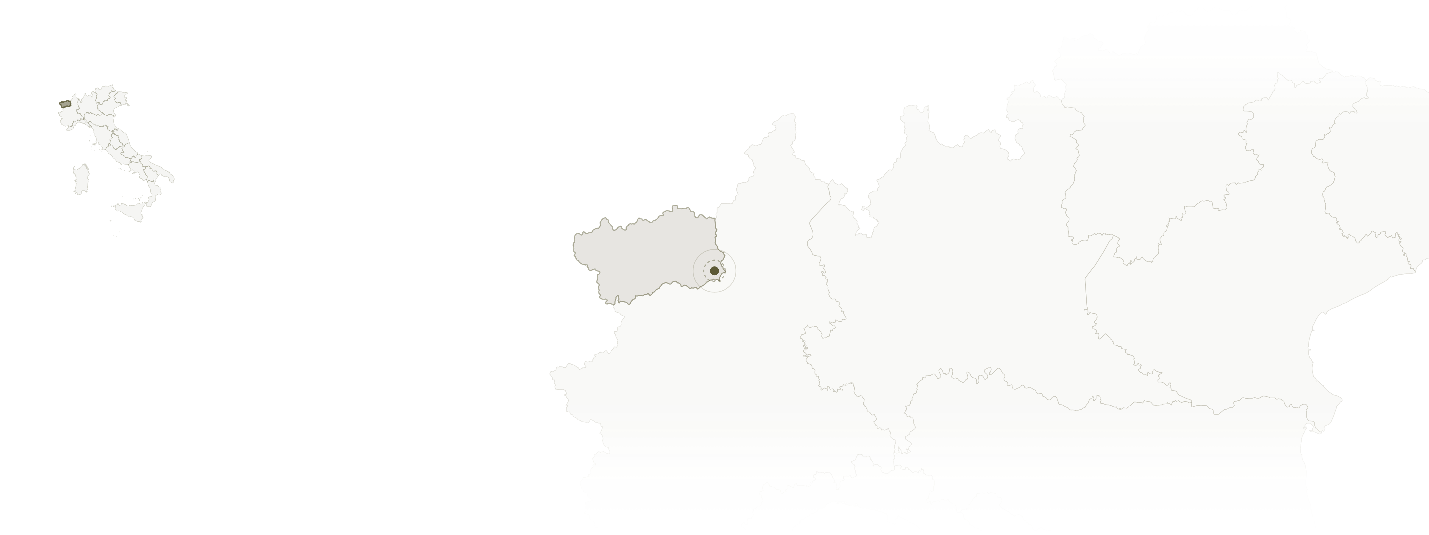
Abandonment mapping in Valle d’Aosta is an example of the recursive nature of work in the territory when conceived in this way. The data produced through the abandonment mapping protocol resulted in a long facilitation project helping a local agency find houses for new families of Italian descent settling in the valley; the information that started as a planning inquiry became a tool that removed friction in real estate scouting, making the insediamento of new residents possible and, in turn, activating new economic possibilities. The re-imagining through sensing sparks action, which in turn changes the image of the territory towards its imagined future. Each step, accumulating capacity and proceeding to uncover the next knot in the five-layered recursive cascade.
Another example of this recursive process was the spinoffs resulting from Transitioning a Landscape: later that year, after having uncovered the opportunities lying in the edges of the forest, we understood that informational preconditions were missing. First, the legibility of the trail infrastructure that made the new economy possible in the first place, which required usage for its maintenance, and could be a vector of communication. Then, along these newly documented trails, the hands-on experimentation with the edges that the research had identified as physical ground, and more precise knowledge of their agroecology.
Both aspects were tackled later that year, respectively, through Reviving Trails and Shaping the Ground, in which detailed databases of trails and autochthonous ancient-fruit species were produced.
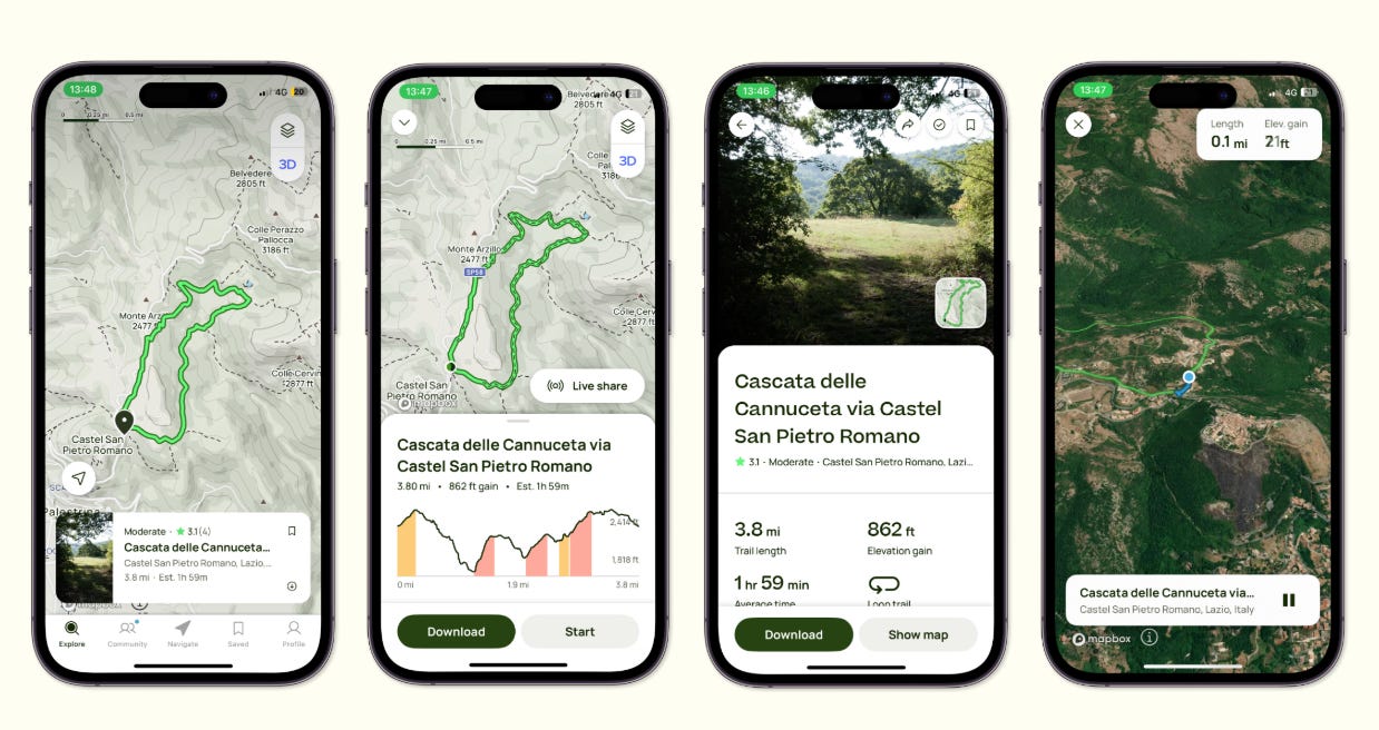
Each Challenge builds three outputs: first, its prototype and impact; then, a methodological update and the automation of its methodology; lastly, a diagnostic of the territory, which informs the next Challenges, and allows the iterative process to continue.
This approach to work requires us to be inside and to be a constitutive part of the system we are trying to read and transform. Since the reading happens through the system’s own reaction to the products of our research, which unveil its structure, paths, and critical points. From this perspective, participation stops being, as commonly conceived, the participation of the stakeholders in our work, but instead our participation as embedded researchers in the processes of the territory.
Protocols as Artificialization
This new conception of the territory requires new institutions that are called to this mission. We imagine that its institutional form could be that of the Applied Research Organization: an institution embedded in the territory, with the role of closing the loop between diagnosis, practice, and policy. Or in other words, between legibility, coordination, and protocol.
The ARO allows for this loop to be carried out continuously. It differs from the existing universities, which carry the loop upwards towards abstraction, replicability, and publication, but not downwards towards practice. And from private interests, which are narrowly focused on the scaling of one solution, and for which fragile territories are rarely a sufficiently dynamic market. The ARO sits in-between, where both research and replicability and local implementation feed each other.
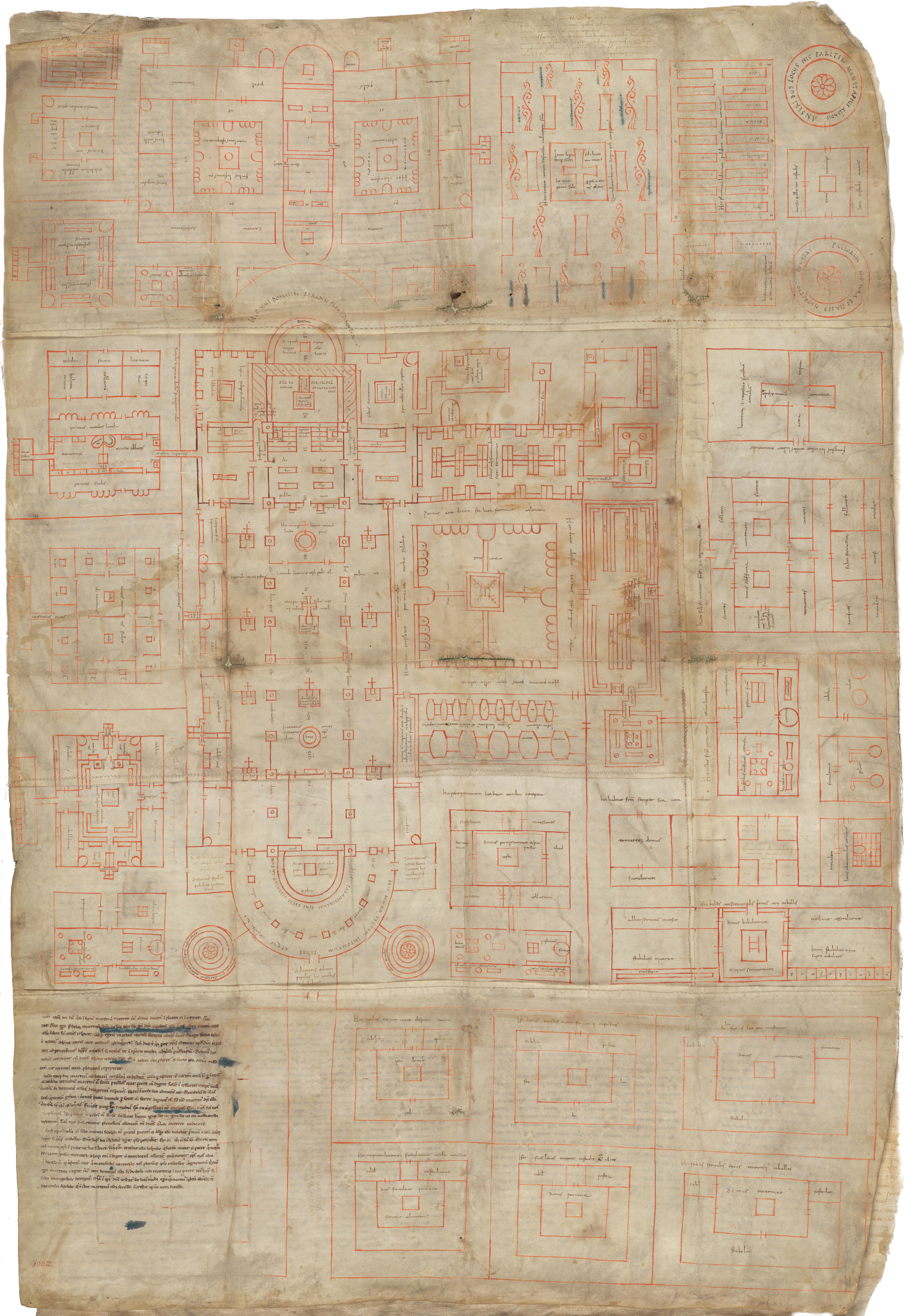
In this way, the ARO inherits the role of the monastery, a hub of competence, not literacy but research ability, and producing not codices but protocols.
The protocol thus becomes the object of design. The designer moves outside the strictly physical and designs the relations between matter, people, incentives, and information flows that enable new possibilities on the land. The protocol has many forms but is ultimately a set of instructions that codifies new flows of labor, matter, information, and attention in a process of artificialization that makes it possible to scale beyond the initial task and, by way of codification, reorganizes one-off niche innovations into persistent routines. The protocol is both the structuring of the relationships between the layers of the territory and its automation, which, by making the flows artificial and repeatable, allows for its complexification.9
The new role of protocolist brings design into governance. Design stops being the design of finished assemblies and becomes the prompting of adaptation, the observation of the dissemination of each experiment into the system, and learning from the feedback. At a local level, a direct practice of territorial statecraft, and at a supralocal level, the negotiation of policies that affect local processes upstream. With the protocol, design becomes a political discipline of technique in service of the transformation of the city, its countryside, and its leaders.
The designer becomes a new kind of orchestrator of the emergent new nature, mediating between layers and curating the territory’s self-perception and protocolization of processes and flows, towards a state of increased capacity. Protocolization as artificialization becomes the engine of capacity accumulation.10 Each action, such as the production of new knowledge, leaves behind a protocol for its replication in other territories without the need for reinvention and leaves behind code that allows the integration of its products into further protocols organizing new economies of place.
From each codification starts the renewed self-perception; from it, the coordination that produces new action updates and extends the protocol. Each step leaves protocols, with the next iteration starting further along, accumulating territorial capacity over time.
Sign up to receive new essays in your inbox, plus early notice on open projects and opportunities.
The archive of past challenges is on Zenodo. For questions, reach out at gabriele@liminalfutures.com.
Challenges are short, applied research and prototyping initiatives through which we deliver pragmatic solutions to issues that keep territories from achieving the self-sustaining processes necessary to escape a state of fragility. During a challenge, a team of researchers lives in the territory for two to six weeks, working with the local actors and producing both an immediately useful prototype and long-term research outputs.
Gunderson, L. H., & Holling, C. S. (Eds.). (2002). Panarchy: Understanding transformations in human and natural systems. Island Press.
Leverage Points: Places to Intervene in a System. (1999). The Academy for Systems Change. Retrieved July 6, 2026, from https://donellameadows.org/archives/leverage-points-places-to-intervene-in-a-system/
Rao, V. (2026). New Nature. Protocolized. https://protocolized.io/features/new-nature
Brand, S. (2018). Pace Layering: How Complex Systems Learn and Keep Learning. Journal of Design and Science. https://doi.org/10.21428/7f2e5f08
Hofstadter, D. R. (1979). Gödel, Escher, Bach: An Eternal Golden Braid. Basic Books.
Leverage Points: Places to Intervene in a System. (1999). The Academy for Systems Change. Retrieved July 6, 2026, from https://donellameadows.org/archives/leverage-points-places-to-intervene-in-a-system/
Cybernetic Culture Research Unit. (2019). Writings 1997–2003. Urbanomic.
Sherman, S. (2024). Planetary Platform Automation. In N. Gilman (Ed.), The Planetary. Berggruen Press.
Bratton, B. H. (2024). Planetary Sapience. In N. Gilman (Ed.), The Planetary. Berggruen Press.